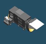
Medium Resolution Spectral Imager-I (MERSI-I)
Description
Spectral imaging instrument in the resolution to probe a system from the Earth's atmosphere, gets the electromagnetic radiation in the 20 channels in multi-spectral information. By imaging, you can implement vegetation, ecology, land cover classification and snow-covered global land surface characteristics.
This instrument has 20 channels on FY-3A/B/C satellites. The MERSI channels are mainly located in visible (VIS) and near-IR (NIR) spectral regions while the Visible and Infrared Radiometer (VIRR) instrument has the important IR channels. These two instruments complement each other. The IR bands from MERSI-I and VIRR can also be used together with the radiance measurements of the sounding instruments for handling clouds in atmospheric profiling.
MERSI-I has five channels (four VIS and one thermal IR) with a spatial resolution of 250 m, which enable imaging of the Earth with high resolution in natural color during the day and high-resolution thermal IR imaging during the night.
Example of remote sensing:
-
8-16 wave channel is high SNR narrow-band channel, can be realized by chlorophyll, suspended sediment and the concentration of soluble yellow substance inversion.
-
2.13 µm channel on the aerosol relatively transparent, combined with a visible channel, you can implement quantitative terrestrial aerosol.
-
remote sensing 0.94 Micron near-infrared moisture absorption of 3 channels, enhances atmospheric water vapor especially low-level moisture detectability.
-
250 m resolution visible light three-channel true color image, you can implement a variety of natural disasters and environmental impact monitoring, monitoring of image Mesoscale convective clouds and surface characteristics of fine.
-
spectral imager with high precision sensing cloud properties, aerosol, land surface, Ocean color, such as the lower water vapor, implements the geophysical elements to air, land and sea of multi-spectral continuous comprehensive observation.
Characteristics
| Satellite | FY-3A , FY-3B , FY-3C |
|---|---|
| No. Channels | 20 (19 narrow-band VIS/NIR/SWIR, 1 broadband IR) |
| Spatial Resolution | 250m (8192 probes) / 1000m (2048 probes) |
| Weight | 117kg |
| Power | 125W |
Characteristics
| Channel | Central wavelength (µm) | Spectral bandwidth (µm) | Spatial Resolution (m) | Noise equivalent reflectivity ρ(%) / temperature difference (300K) | Dynamic range (max reflectivity ρ / maximum temperature K) |
|---|---|---|---|---|---|
| 1 | 0.470 | 0.05 | 250 | 0.45 | 100% |
| 2 | 0.550 | 0.05 | 250 | 0.4 | 100% |
| 3 | 0.650 | 0.05 | 250 | 0.3 | 100% |
| 4 | 0.865 | 0.05 | 250 | 0.3 | 100% |
| 5 | 11.25 | 2.5 | 250 | 0.4 K | 330k |
| 6 | 0.412 | 0.02 | 1000 | 0.1 | 80% |
| 7 | 0.443 | 0.02 | 1000 | 0.1 | 80% |
| 8 | 0.490 | 0.02 | 1000 | 0.05 | 80% |
| 9 | 0.520 | 0.02 | 1000 | 0.05 | 80% |
| 10 | 0.565 | 0.02 | 1000 | 0.05 | 80% |
| 11 | 0.650 | 0.02 | 1000 | 0.05 | 80% |
| 12 | 0.685 | 0.02 | 1000 | 0.05 | 80% |
| 13 | 0.765 | 0.02 | 1000 | 0.05 | 80% |
| 14 | 0.865 | 0.02 | 1000 | 0.05 | 80% |
| 15 | 0.905 | 0.02 | 1000 | 0.10 | 90% |
| 16 | 0.940 | 0.02 | 1000 | 0.10 | 90% |
| 17 | 0.980 | 0.02 | 1000 | 0.10 | 90% |
| 18 | 1.030 | 0.02 | 1000 | 0.10 | 90% |
| 19 | 1.640 | 0.05 | 1000 | 0.05 | 90% |
| 20 | 2.130 | 0.05 | 1000 | 0.05 | 90% |
Data and Products
| Satellite | Instrument | Datasets |
|---|---|---|
| FY-3C | MERSI-I | L1 data, L2L3 product |
| FY-3B | MERSI-I | L1 data, L2L3 product |
| FY-3A | MERSI-I | L1 data, L2L3 product |
