In addition to the most common forms of natural disasters, there are other types of disasters which may benefit from satellite observations.
Maze
A maze is a path or collection of paths, typically from an entrance to a goal. The word is used to refer both to branching tour puzzles through which the solver must find a route, and to simpler non-branching patterns that lead unambiguously through a convoluted layout to a goal. The pathways and walls in a maze are typically fixed, but puzzles in which the walls and paths can change during the game are also categorised as mazes or tour puzzles.
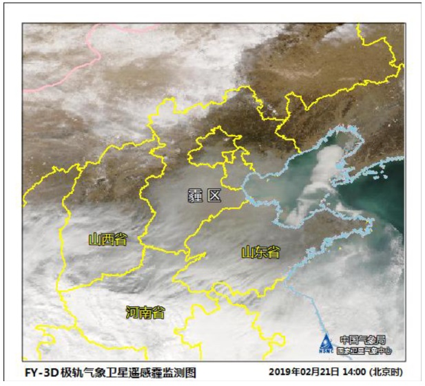
Fig. Maze in northern China on February 21, 2019 by FY-3D.
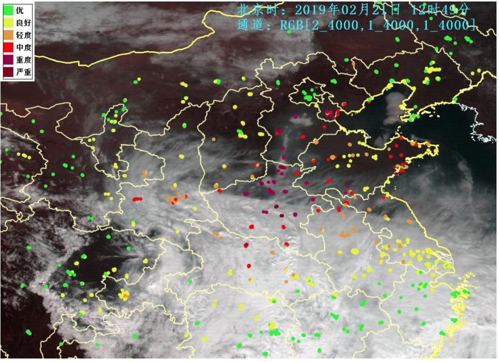
Fig. Maze in northern China on February 21, 2019 by FY-4A.
Fog
Fog is a visible aerosol consisting of tiny water droplets or ice crystals suspended in the air at or near the Earth's surface. Fog can be considered a type of low-lying cloud, usually resembling stratus, and is heavily influenced by nearby bodies of water, topography, and wind conditions.

Fig. Fog in eastern China on March 19, 2019 by FY-4A.
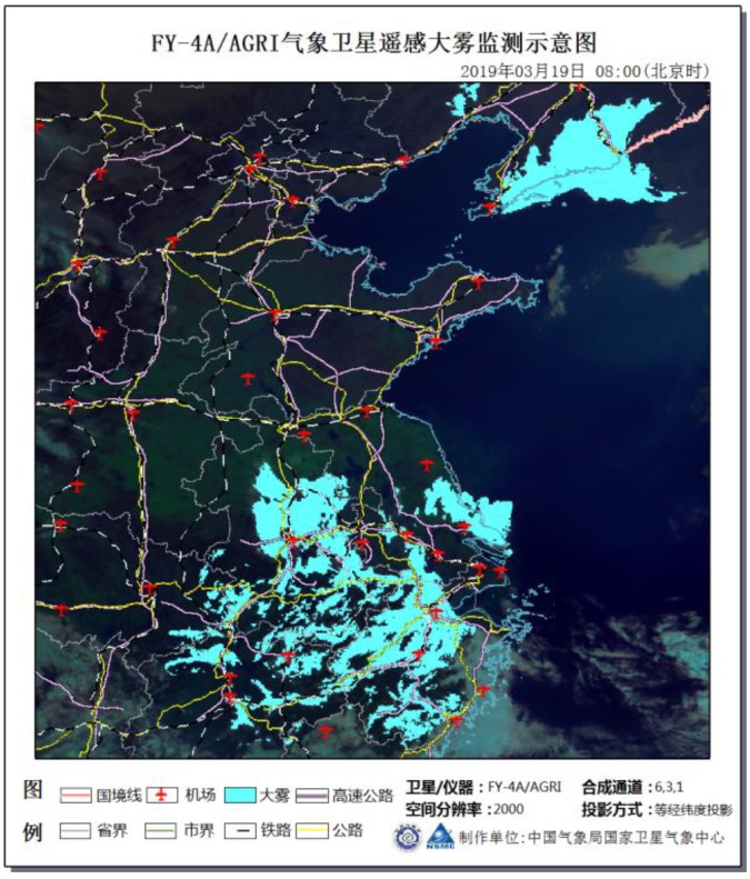
Fig. Fog in eastern China on March 19, 2019 by FY-4A.
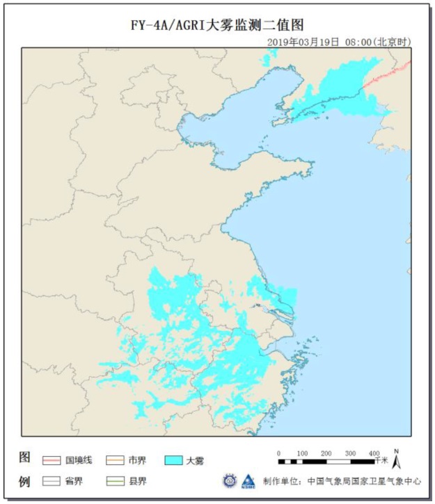
Fig. Fog in eastern China on March 19, 2019 by FY-4A.
Heat wave
A heat wave is a period of excessively hot weather, which may be accompanied by high humidity, especially in oceanic climate countries. While definitions vary, a heat wave is usually measured relative to the usual weather in the area and relative to normal temperatures for the season.

Fig. Heat wave in Australia on January 24, 2019 by FY-4A.
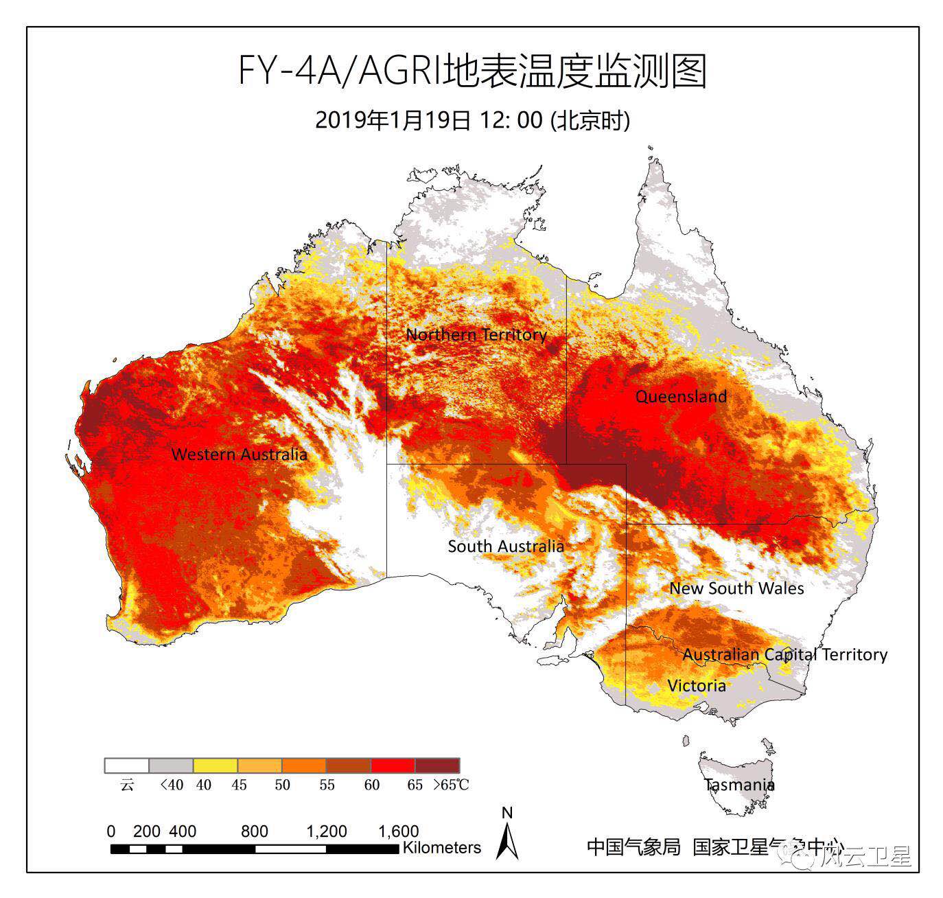
Fig. Land surface temperature on January 19, 2019 (5 days before the heat
wave in Australia) by FY-4A.
Locusts
Locusts is a group of large and mainly tropical grasshoppers with strong powers of flight. From time to time there is a population explosion, and it migrates in vast swarms that cause extensive damage to crops.
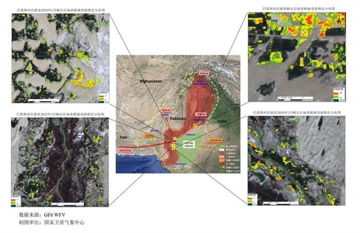
Fig. Fengyun satellites data is used to make remote sensing-based assessment on vegetation
damage in Pakistan in February 2020.
Vegetation
Vegetation indices are designed to maximize sensitivity to the vegetation characteristics while minimizing confounding factors such as soil background reflectance, directional, or atmospheric effects.

Fig. Global Vegetation monitoring by FY-3C on July 10, 2014.
Ozone
Ozone near the ground is monitored because it is a product of industrial and urban pollution. Measurements of tropospheric and stratospheric ozone are used for the verification of models that simulate the photochemistry or general circulation of the real atmosphere. Ozone is also measured to determine attenuation of the ozone layer by man-made gases, to validate model estimations of changes in ozone and to confirm the efficiency of the Montreal Protocol on Substances that deplete the Ozone Layer and its Amendments.

Fig. Antarctic ozone monitoring by FY-3A from August 2008 to January 2009.