Volcano Hunga Tonga-Hunga Ha'apai (175.38°W, 20.57°S) erupted at about 04:10 (UTC) on January 15, 2022.
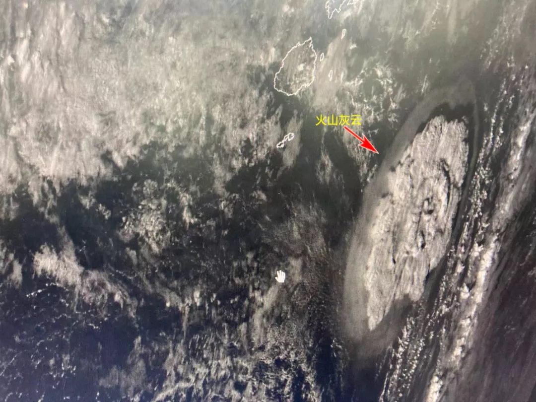
Image by FY-4B at 05:00 (UTC) on January 15, 2022. The monitored volcanic ash cloud had diameter 500km and caused shock wave around.
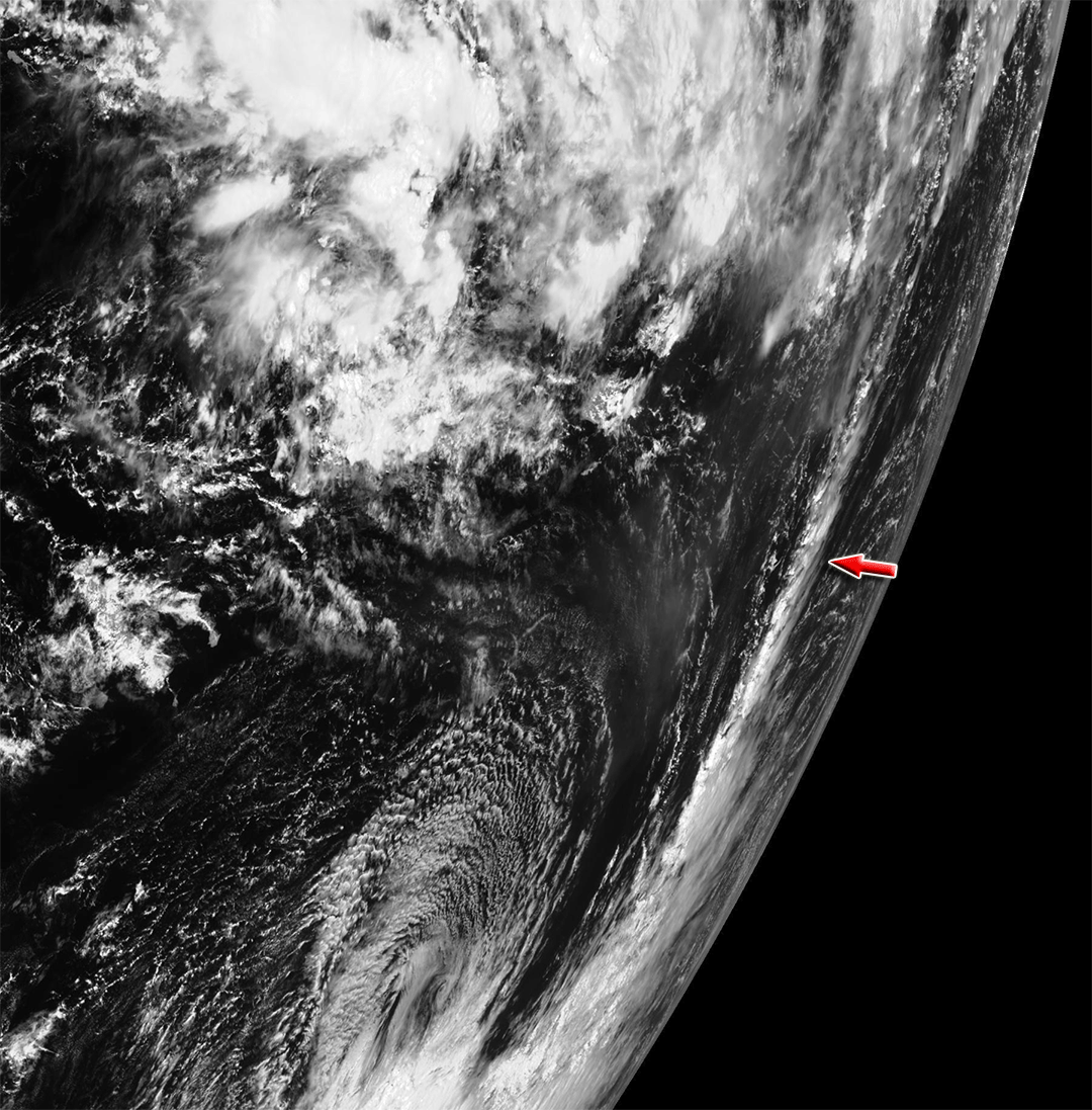
Image by FY-4B (located at 123.5°E) from 03:15 to 06:30 (UTC) on January 15, 2022.
Image by FY-2F (located at 112°E) from 02:00 to 06:00 (UTC) on January 15, 2022.
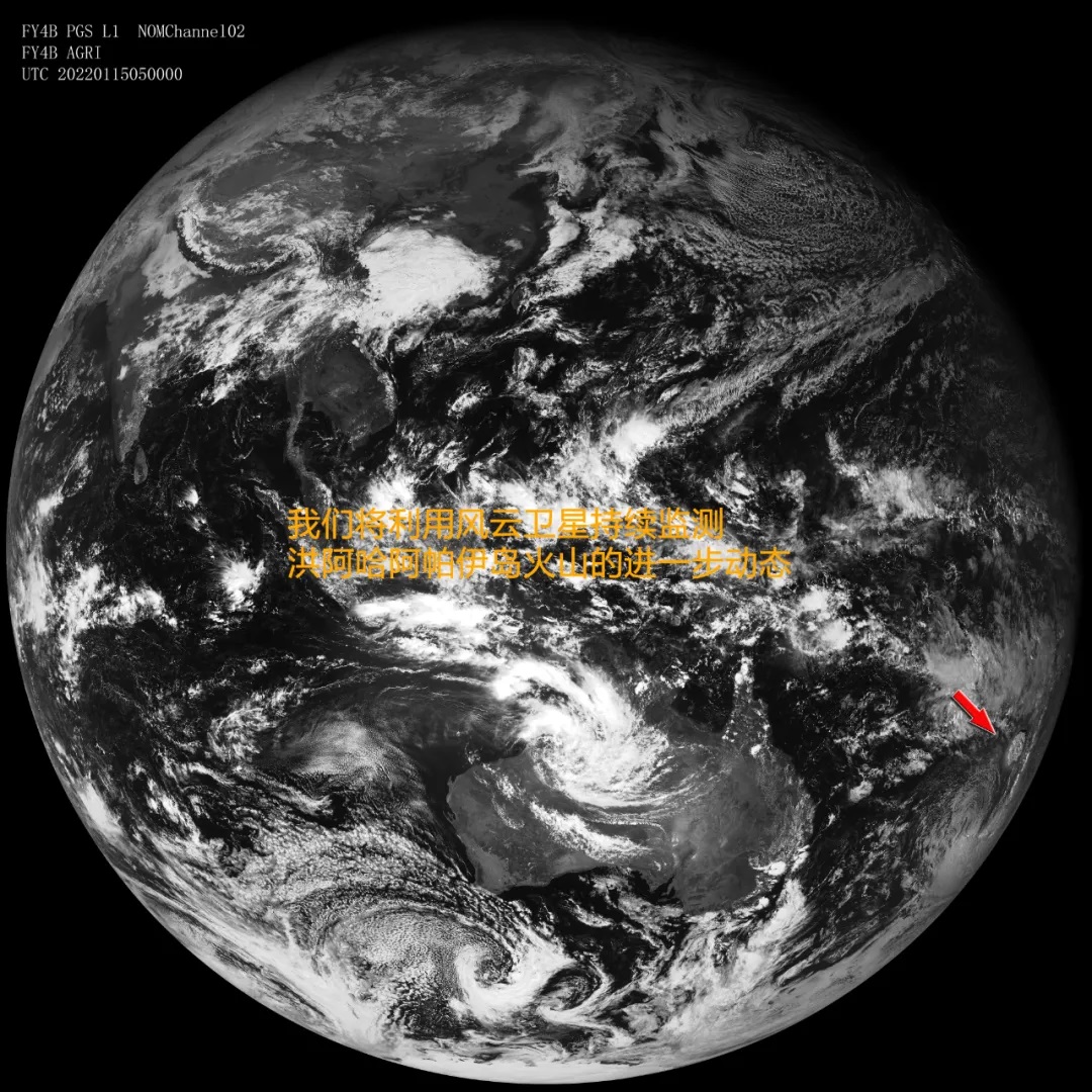
Image by FY-4B at 05:00 (UTC) on January 15, 2022.
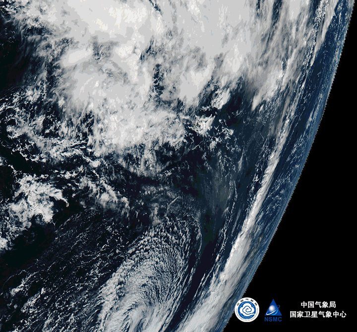
Image by FY-4B from 02:45 to 08:00 UTC (from 15:45 to 21:00, Tonga standard time) on January 15, 2022.
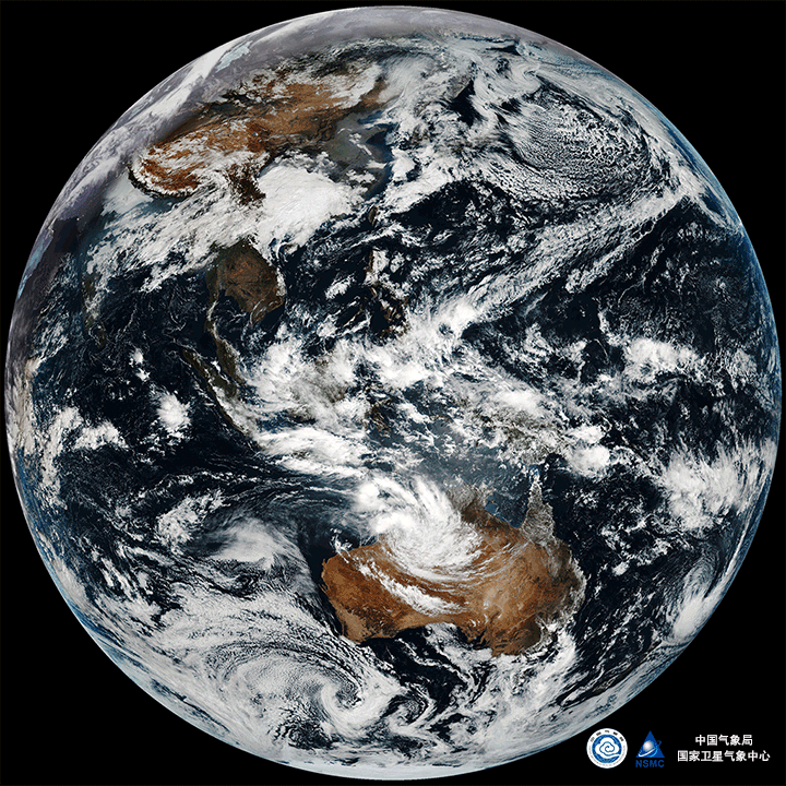
Full disk Image by FY-4B from 02:45 to 08:00 (UTC) (from 15:45 to 21:00, Tonga standard time) on January 15, 2022.
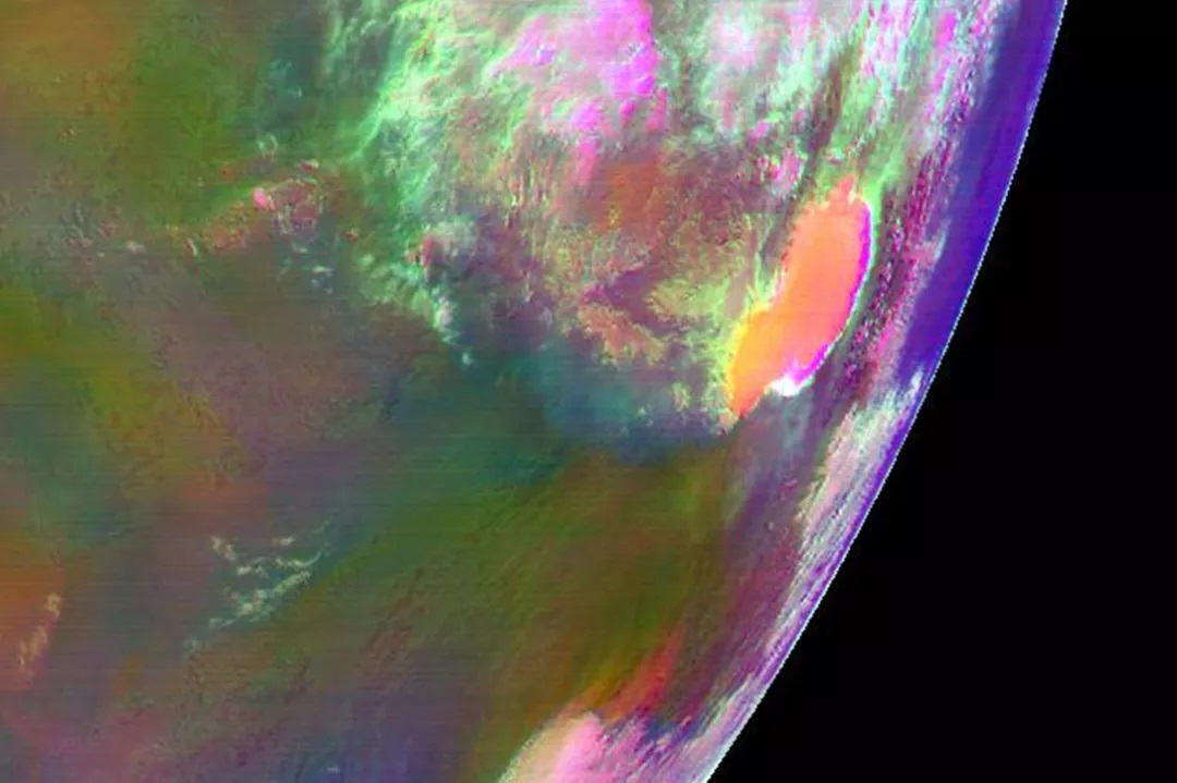
Colored image by FY-4B at 07:30 (UTC) (20:30, Tonga standard time) on January 15, 2022.
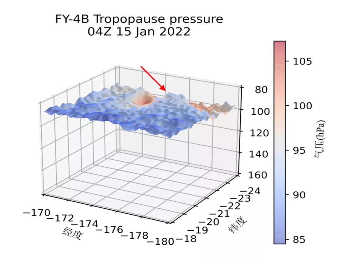
Cloud Top Pressure dropped from 100hPa to 80hPa above the volcano at 06:00 (UTC) (19:00, Tonga standard time) on January 15, 2022.
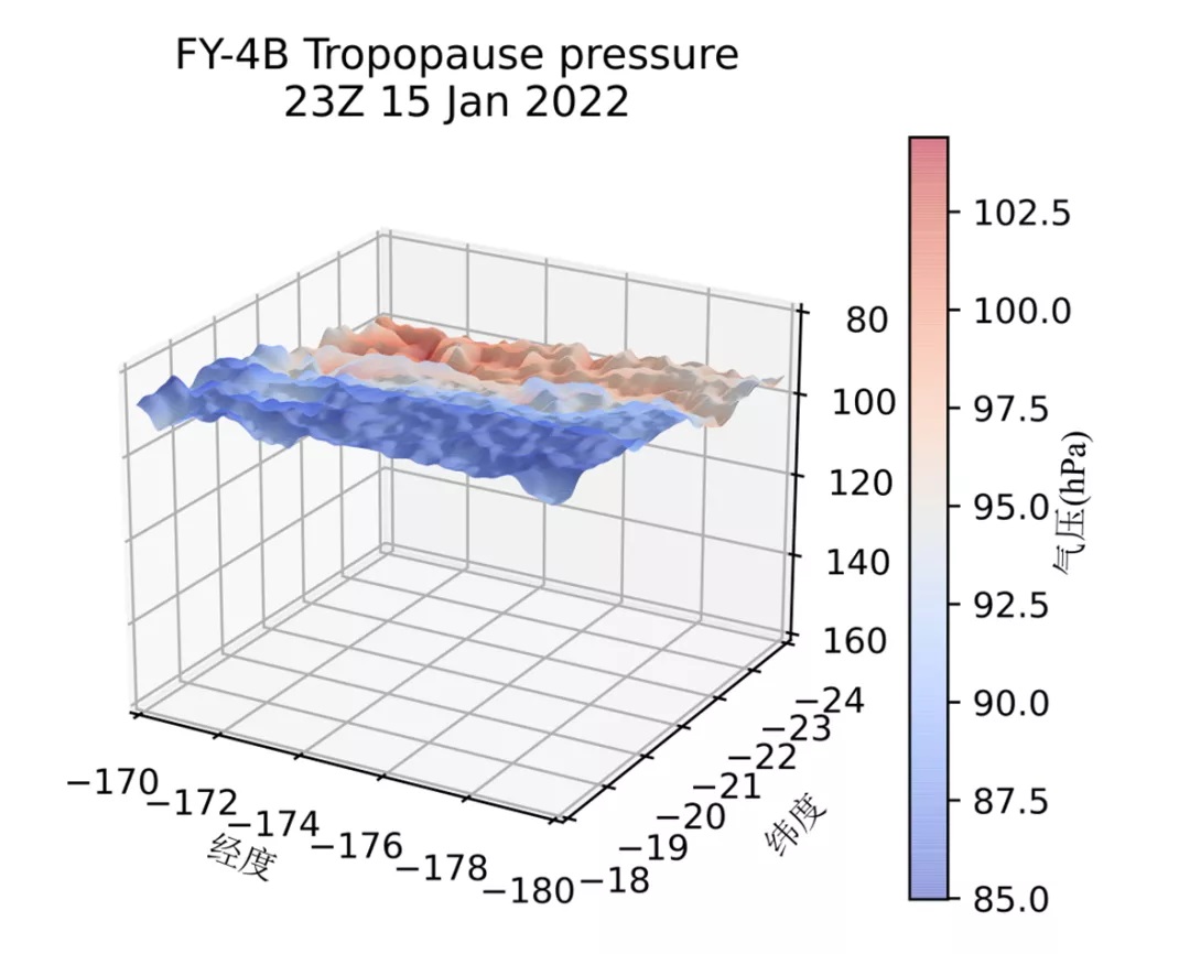
Cloud Top Pressure went back to around 100hPa at 23:00 (UTC) on January 15, 2022 (12:00 of January 16, Tonga standard time).
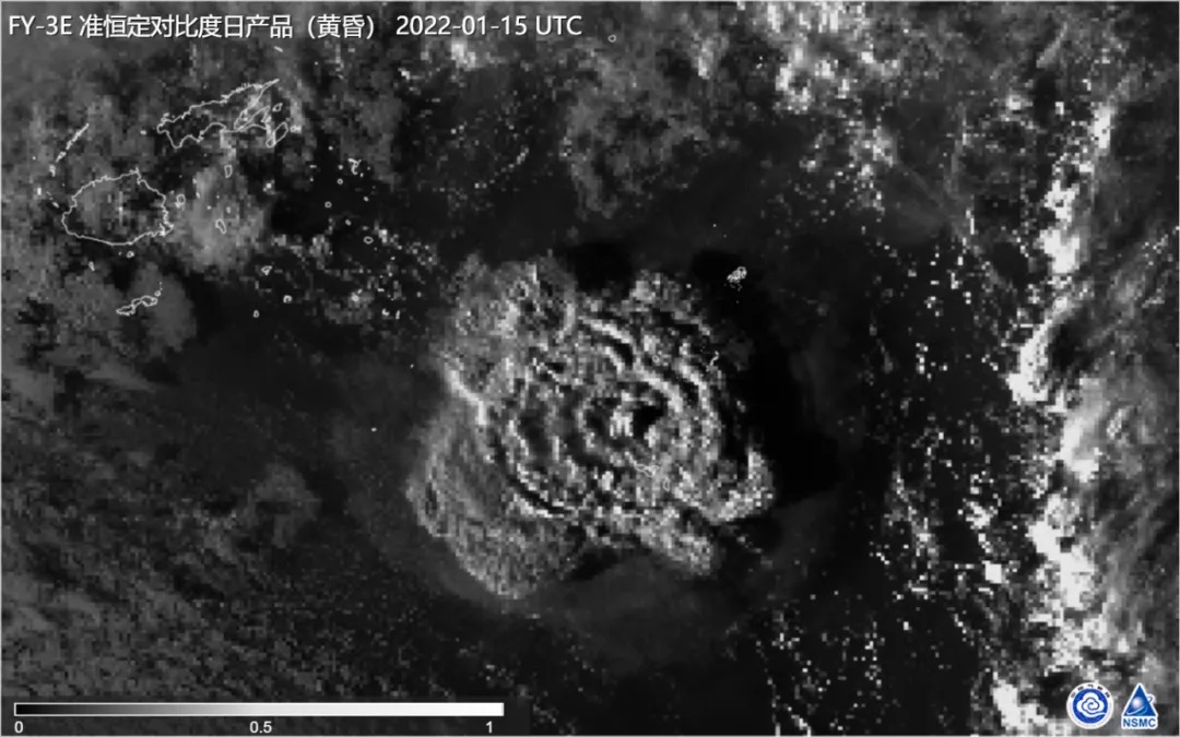
Enhanced twilight image by FY-3E at 05:00 (UTC) (18:00, Tonga standard time) on January 15, 2022.
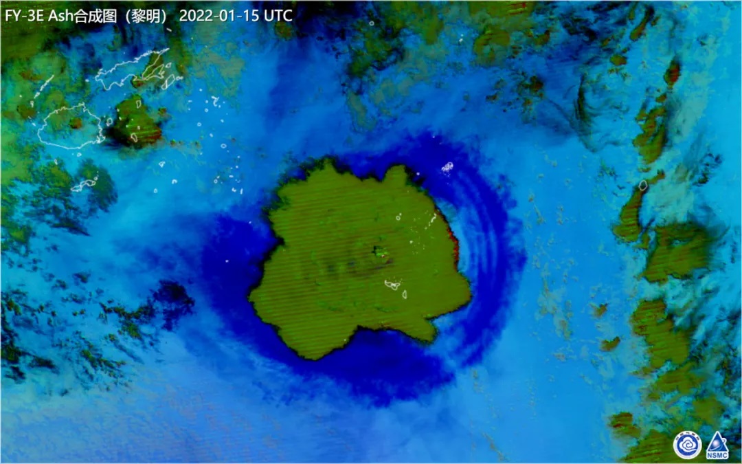
Colored image by FY-3E at 05:00 (UTC) (18:00, Tonga standard time) on January 15, 2022.
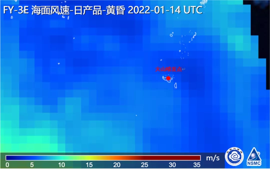
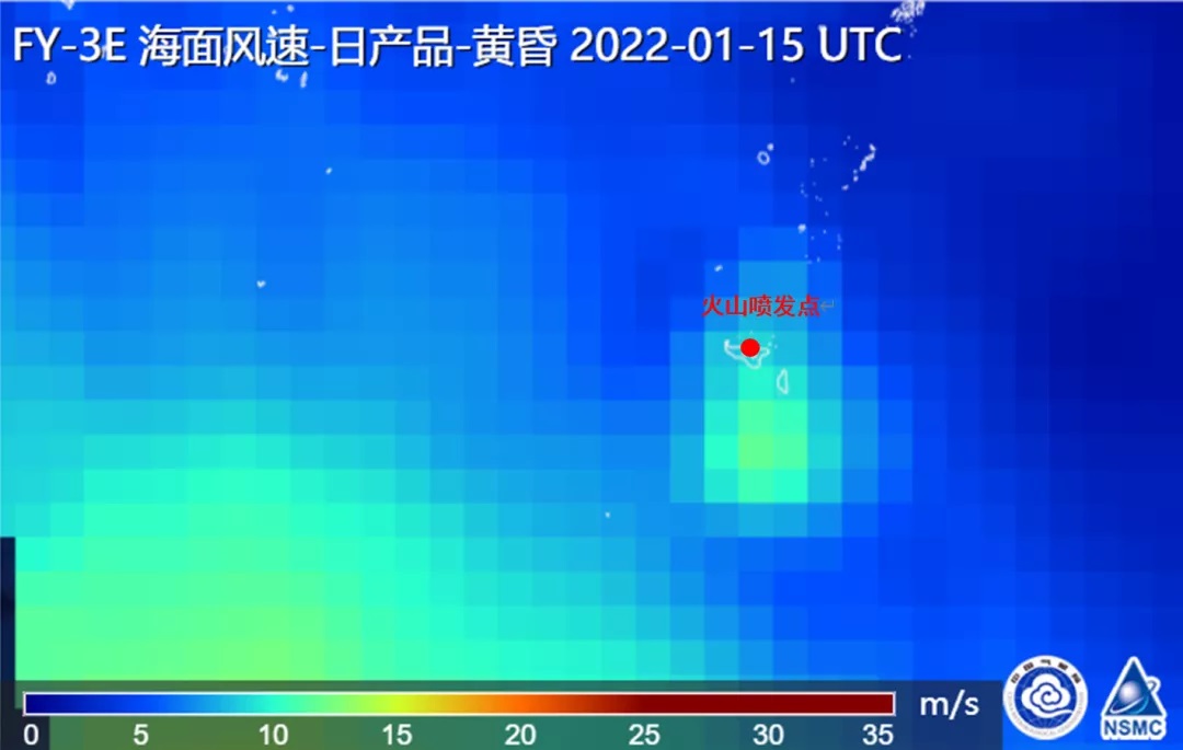
Ocean surface wind speed product by FY-3E WindRad showed unusual waves after the eruption.
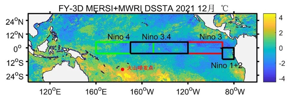
Sea Surface Temperature analysis by FY-3D will follow the ocean-atmosphere influence to the La Nina of the eruption.
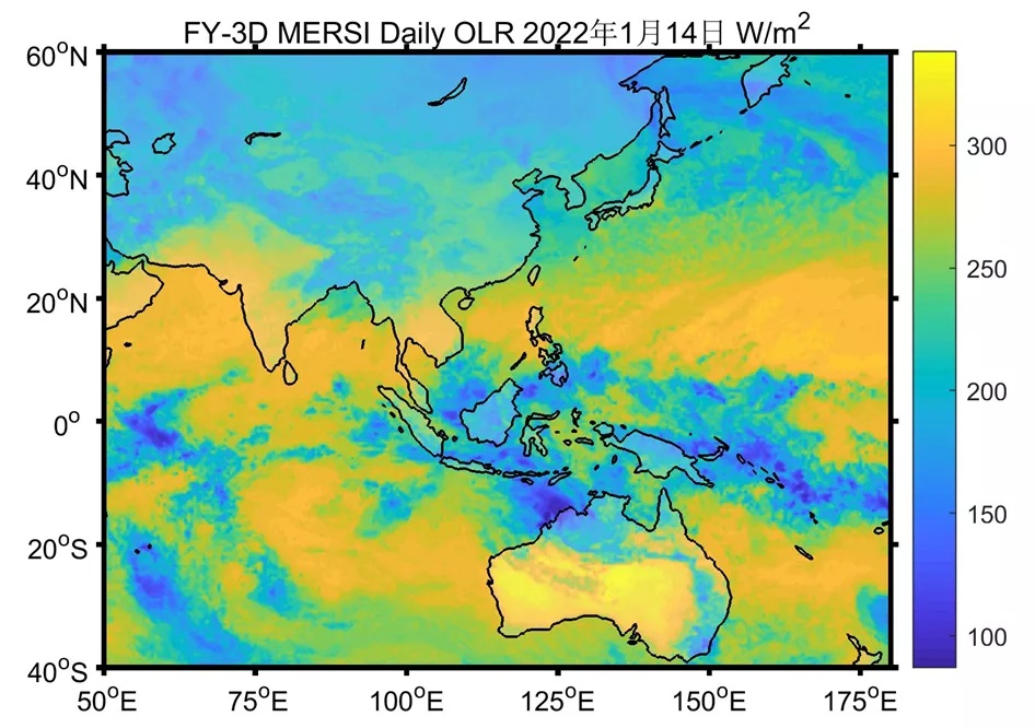
There were strong convections above Indonesia before the eruption and the spreading of the volcanic ash to the west.
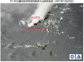
Small eruptions were monitored by FY-3D from December 20 to 23, 2021.
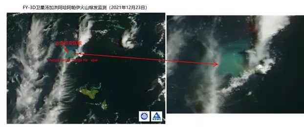
Sea water color around the volcano changed with an area of about 600 km2 on December 23 2021, due to the eutrophication of water which was heated by the eruptions.
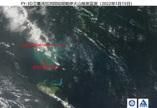
Sea water color around the volcano changed with an area of about 1590 km2 before the large eruption on January 14, 2022.
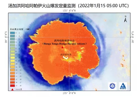
Cloud Top Height by GEO monitored the volcanic ash cloud with height of 15~16km and maximum height 18km at 05:00 (UTC) on January 15, 2022.
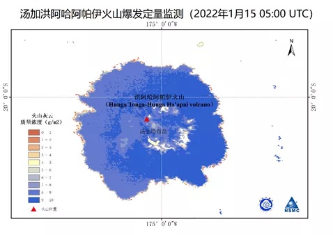
The volcanic ash has a total weight of 3.6 million tons and a relatively large mass concentration of 7~10 g/m2, which means that most of the ash will fall out soon.
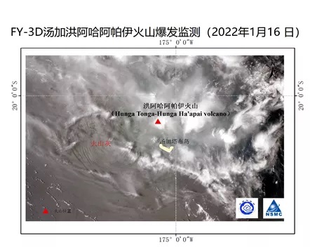
Image by FY-3D at 01:30 (UTC) on January 16 shows heavy articles of the volcanic ash has fallen on the sea surface in the west of the volcano.
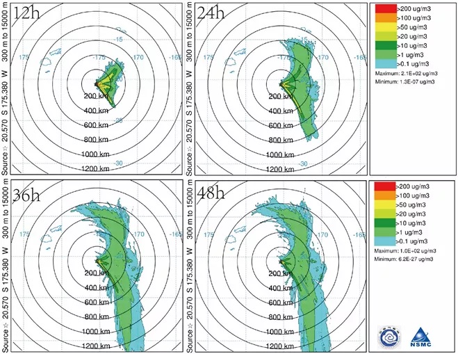
HYSPLIT 48h model predicts that the small articles in the volcanic ash will spread to the east.
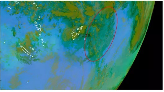
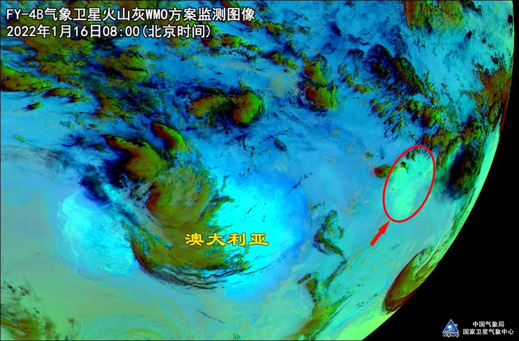
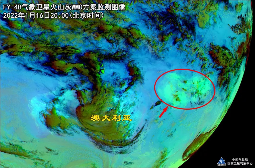
GEO image in WMO Volcanic Ash mode shows that the small articles in the volcanic ash is actually spreading to the east.
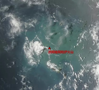
Image by FY-3D shows no volcanic activity at 01:10 (UTC) on January 17, 2022.
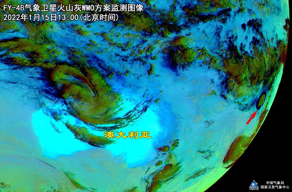

Image by FY-4B in WMO Volcanic Ash mode shows large amount articles after eruption at 05:00 (UTC) on January 15, 2022.
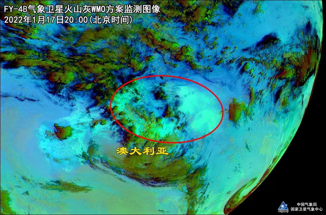
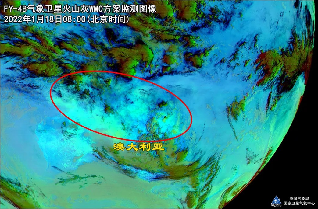
Some of the articles were spreading to west from January 15 to 18, 2022.
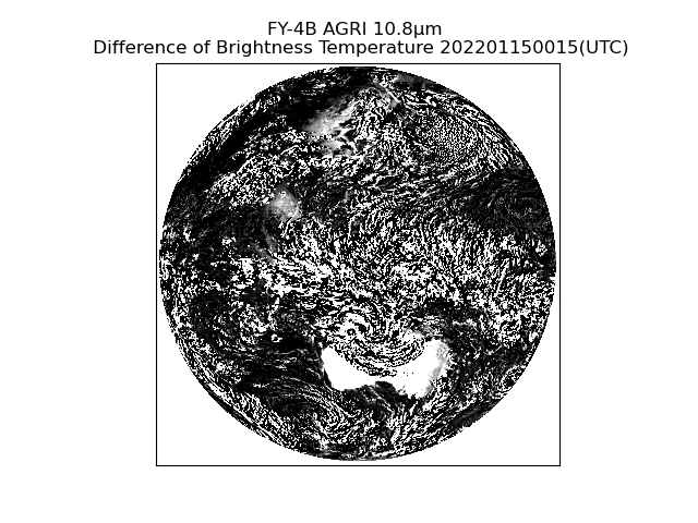
Atmosphere shockwave monitored by FY-4B 10.8μm band on January 15, 2022.